How Digital Twins Track Mining's Environmental Impact
Hexagon's green technology subsidiary, R-evolution, has begun airborne LiDAR flights over Vale's Mina de Águas Claras mining site in Brazil. The flights aim to create 3D digital representations of the entire mining operation and surrounding environment to track ecological conditions across the 1,908-hectare facility.
The system combines LiDAR technology with high-resolution imagery to map forest ecosystems around extraction sites. According to Hexagon, the approach could provide mining operators with data to assess environmental impact and monitor habitat restoration efforts at operational and decommissioned sites.
The technology deployment represents part of a broader initiative to integrate environmental monitoring into mining operations. R-evolution's Green Cubes platform integrates multiple data-collection methods to create comprehensive digital records of mining environments and their surrounding ecosystems.

Mining's environmental footprint
Mining operations produce materials needed for renewable energy infrastructure, including lithium and copper for batteries and electrical systems. However, extraction processes can affect local ecosystems through deforestation, habitat disruption and resource consumption that alter landscapes.
Transportation and extraction activities generate emissions that contribute to temperature changes. The sector faces increasing pressure to demonstrate environmental stewardship whilst meeting demand for materials essential to energy transition technologies.
Visibility into how operations affect surrounding environments remains limited across the sector. Traditional monitoring methods often rely on periodic ground surveys that provide limited coverage and infrequent updates on ecosystem changes.
Reclamation programmes have been introduced at some sites to address these concerns. These initiatives typically focus on restoring vegetation, stabilising soil and re-establishing wildlife corridors in areas affected by extraction activities.
Hexagon's R-evolution has developed technology intended to support these efforts through continuous monitoring capabilities. The company's Green Cubes system integrates multiple data capture methods to provide operators with detailed environmental intelligence.
These include satellite monitoring for broad-area coverage, airborne LiDAR for detailed terrain mapping, terrestrial scanning for ground-level detail, camera traps for wildlife observation, acoustic sensors for biodiversity assessment, and ground-penetrating radar for subsurface analysis.
Digital monitoring system deployed
R-evolution announced on 15 April the launch of flights using Leica Geosystems' hybrid airborne system. The technology captures LiDAR data and imagery simultaneously during flight operations, creating layered datasets that combine structural measurements with visual information.
The flights cover more than 20 square kilometres at Vale's site near Belo Horizonte in Minas Gerais state. The resulting digital twin provides 10-centimetre-resolution mapping of the 1,908-hectare mine and nearby protected areas, delivering precision sufficient to identify individual trees and vegetation patterns.
Data collected during flights passes through an AI-powered platform that analyses forest structure and composition. The system records details including tree positioning, canopy density, ground vegetation coverage and branch networks that indicate ecosystem health.
The platform processes imagery to identify plant species and track changes in vegetation over time. Operators can compare datasets from multiple flights to measure restoration progress and detect areas requiring intervention.
"Green Cubes is redefining how the extraction industry approaches environmental responsibility – providing transparency from space to the roots," says Erik Josefsson, President of Hexagon's R-evolution.
"By embedding Green Cubes digital reality into the mining life cycle, we're enabling our mining partners to accelerate restoration, improve compliance and unlock new value through natural capital."
The system generates baseline measurements that operators can use to establish restoration targets. Repeated surveys create time-series data showing how ecosystems respond to reclamation activities and natural regeneration processes.
Results at Brazilian site
Vale has deployed the technology at Mina de Águas Claras, where a repurposing project is underway to transform sections of the mining operation. According to Vale, camera and sound traps enhanced by AI have identified more than 140 bird species over 90 days of monitoring.
The company reports recording its first Puma concolor sighting in 10 years at the location. Maned wolves were also captured on video at the site for the first time, suggesting habitat conditions may be improving in restored areas.
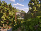
The monitoring system includes educational components designed to engage local communities in conservation efforts. Hexagon has created a Minecraft recreation of the mining site to teach younger audiences about biodiversity and conservation principles through interactive gameplay.
An initial test on the Minecraft Agonia server attracted 14,000 players who explored the virtual environment. The game environment allows users to explore the virtual ecosystem and learn how mining operations intersect with habitat restoration initiatives.
Samarco, another iron ore producer operating in Brazil, has implemented Green Cubes across its operations. The company is considering expansion to additional sites and applications as it evaluates the technology's effectiveness in supporting environmental management objectives.
The technology provides mining companies with environmental data as demand for extracted materials increases globally. Access to detailed ecosystem monitoring could inform operational decisions at sites where extraction activities occur near protected habitats, potentially reducing conflicts between industrial operations and conservation priorities.